Amba ghat
Amba is situated on the western ghats at the height of 3100 feet on Kolhapur - Ratnagiri national highway (NH-204) and this is the highest spot in Kolhapur district. Amba is actually a reserve forest area which falls in the buffer zone of the Sahyadri Tiger Reserve and Dajipur Bison Sanctuary.
Today, Amba ghat is a a beautiful hill Station in Maharashtra, unlike other hill stations it has limited tourist traffic and was recently awarded the world heritage status. Amba's serene and natural surroundings make it a complete de-stress zone and one can spend hours staring at the silent valleys below.
Amba ghat is blessed with a rich variety of flora and fauna and being amidst of the Dajipur Bison sanctuary, it is a bird watcher's paradise offering a wide variety of wildlife. Similarly, there is a large variety of plants and trees and one will find the rare Tamhan flower tree here, which has been declared the state flower of Maharashtra. To add to the tourist's delight they will get great pleasure in plucking and eating fruits like Java plums (jamun/jambhul) or Rose-apples which are found here in abundance.
The Amba Ghat hugs the Sahyadri mountain ranges at a height of 2000 ft above sea level. It is a mountain pass on the NH204 (Ratnagiri-Kolhapur Highway). This mountain pass acted as a connecting link from Kolhapur to the Konkan during Shivaji Maharaj’s time.
It is in close proximity to the historical Pawankhind and the Vishalgad Fort as also Rehan Baba Dargah. It is now a venue for paragliding adventure sport. Amba Ghat is well known for its beautiful verdant surroundings and cool weather and is a convenient tourist destination for short weekend holidays.
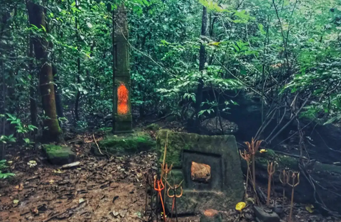
Ambeshwar devrai ( sacred grove)
This scared groove in the village Amba is maintained by the villagers for hundreds of years. It is a home to a variety of flora and fauna. It is a treasure trove for the botanists. You can see various species of horn bills like Malabar pied horn bill, Great horn bill and Malabar grey horn bill, Asian paradise flycatcher and many other birds here. It is a bird watcher's paradise.
Devrai, also known as sacred groves, are patches of forests that are considered sacred in Indian culture. These groves have been preserved and protected by local communities for generations and play an essential role in the conservation of biodiversity in the region.
The term "Devrai" is derived from two words: "dev" which means God, and "rai" which means a patch of land. Devrai, thus, means a patch of land dedicated to God.
These sacred groves are found all over India, from the Western Ghats to the Himalayas, and are an important part of the cultural and religious heritage of the country. They are typically located near temples, and are considered to be the abode of the local deities. They are also associated with traditional beliefs and practices that are deeply rooted in the local culture.
Devrai are important for the conservation of biodiversity in the region. The groves are often home to a wide variety of plant and animal species, including many that are endangered or rare. This is because the groves are often located in areas that have not been significantly impacted by human activities such as logging, grazing, and cultivation.
Pawankhind
The Battle of Pavan Khind ; was a rearguard last stand that took place on 13 July 1660, at a mountain pass in the vicinity of fort Vishalgad, near the city of Kolhapur by the Maratha general Baji Prabhu Deshpande and Shambhu Singh Jadhav against Siddi Masud of the Bijapur Sultanate. The engagement ended with the destruction of the Maratha forces, and a tactical victory for the Bijapur Sultanate that failed to achieve a strategic victory.
Shivaji, facing a siege at Panhala Fort, first scouted an escape route through the besiegers' lines. On July 13, 1660, under the cover of darkness and aided by rain, Shivaji slipped out of the fort with 600 infantry and headed to Vishalgad. He was pursued by Siddi Jauhar’s forces led by his son-in-law, Siddi Masud, resulting in a fierce battle at the Gajapur pass. Baji Prabhu, Shivaji's ally, fought valiantly but was killed. Shivaji successfully reached Vishalgad, covering 64 km in 21 hours, and then proceeded to Rajgad.
The Bandals were honored for their bravery in delaying the enemy's pursuit. Shivaji punished Khandoji Khopade for his betrayal by amputating one hand and one leg, while Kanhoji Jedhe, Shivaji's trusted servant, passed away around September 1660.
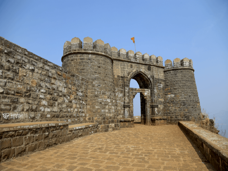
Vishalgad fort
Vishalgad Fort was built in the year 1058 by a Shilahara ruler 'Marsinh' and was initially known as 'Khilgil' fort. But down the centuries it passed into the hands of many rulers who ruled around the Deccan region
The name Vishalgad means grand or giant fort. King Shivaji gave the fort its name after conquering it in 1659. The fort covers an area of 1,130m and is located at a height of 3,500 feet above sea level. Located at around 80km from Kolhapur, Vishalgad fort could be reached within two hours of drive from the city
Vishalgad fort was among the most prominent forts of Shivaji Maharaj. It was one of the important forts of Maratha Empire. It is also known as Khelna or Khilna Fort.
The fort is popular for the battle fought between the Maratha sardar Baji Prabhu and Siddi Masud of Bijapur Sultanate while King Shivaji reached the fort safely passing through steep slopes and dense forest. The name Vishalgad means grand or giant fort. King Shivaji gave the fort its name after conquering it in 1659.
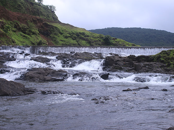
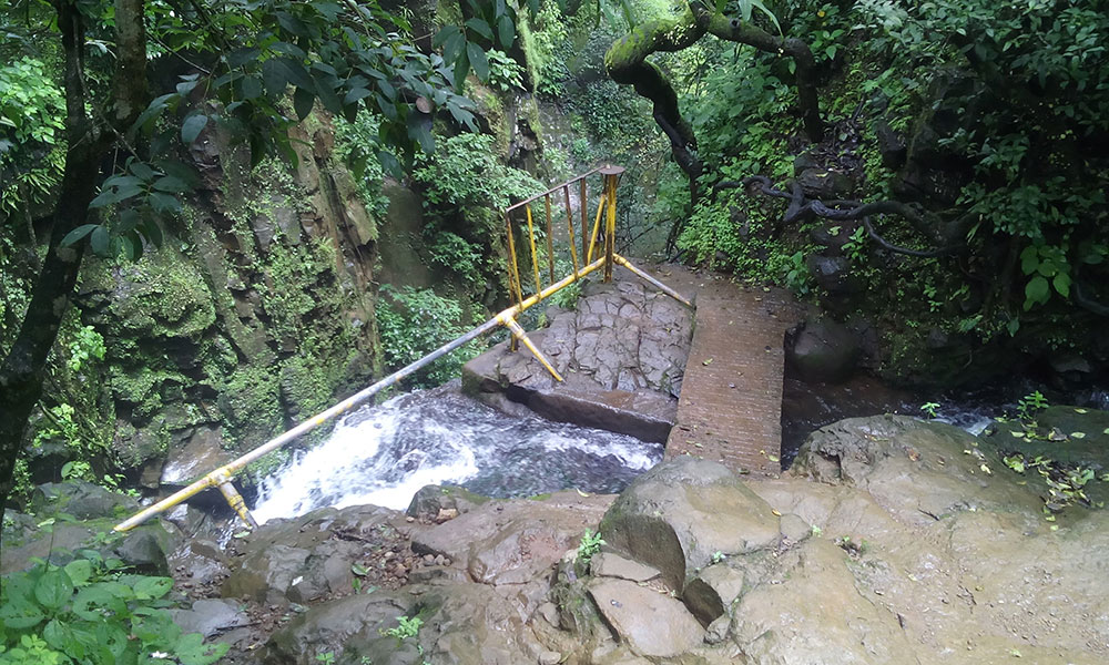
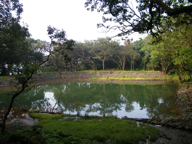
Manoli dam
Manoli Minor Irrigation Project situated at village Manoli has unique locational advantages as it is placed in hilly areas of Amba Valley. Manoli with a reservoir of 0.18 TMC capacity. The entire surrounding and ambience enjoys rich floura and fauna nearly green through out the year.
Manoli village being situated in Abode of Amba Valley with dense jungle has tremendous potential for tourism. The waste weir wall of Manoli MI Tank provides beautiful Waterfall location and thousand of Tourist visit every year to enjoy the view and waterfall in Monsoon season. Manoli lake is having navigation facility and people are enjoying this facility.
Manoli Dam has number of Resorts, Hotels and lodging to facilitate tourist for easy stay and comfortable enjoyable vacation.
Manoli Dam also being situated itself in Amba Valley has nearby tourist places like Amba Ghat (4.6 Km), Ambeshwar Temple (1.4 km),Wagh Zara(8.1 Km), Vishalgad Fort (21.2 Km), Pawankhind (19 Km), Nanji Math (38 Km).
Waghzara
This point would have been very beautiful if not for human interference. A watering place for wildlife. Madhi is a watershed and its forest. I felt that it was wrong to point out such a place for tourists. Garbage after row. If someone litters, remove him.
Kolhapur
It is one of the best places to explore the splendor and magnificence of India. Kolhapur is about 387 km from the Mumbai, the financial capital of India and is famous for the Indian handcrafted leather slippers the kolhapuri chappals and its unique local jewelry a special type of necklace called Kolhapuri Saaj.
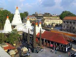
Kolhapur, an epitome of beauty and richness in the Indian state of Maharashtra, stands tall as one of the most significant cities in South Maharashtra. With its rich cultural heritage, this city has been a hub of historical, religious, and cultural activities for centuries. Its historic significance can be traced back to the 1st century BC and continues to amaze visitors with its intricate carvings and magnificent temples. Kolhapur is famous for its unique food culture, including its signature Kolhapuri cuisine, that tantalizes the taste buds of locals and tourists alike. Sports, arts and local dialects also play a major role in defining the identity of the city, making it a true representation of diversity and unity. The city is situated in the western part of Maharashtra and is often referred to as "Dakshin Kashi" or "Mahateerth". It boasts a rich history, which has given it various other names, including Kollagiri, Kolladigiripattan and Kollpur, all meaning "valley" Around 2 C.E. Kolhapur's name was 'Kuntal'.
Kolhapur is named after Kolhasur, a demon in Hindu History.According to legend, the demon Kolhasur renounced asceticism after his sons were killed by the gods for harassing people. He prayed to Mahalakshmi, requesting that she leave the area to him for a hundred years. He committed numerous crimes during this period until the goddess returned after the hundred years were over and killed him for his sins.Kolhasur's dying wish was to name the place after him, a request granted, and the area was named Kolhapur. 'Kolha' represents Kolhasur, and 'pur,' a Sanskrit word, means 'city.'
Stone inscriptions from the Shilahar kingdom, which ruled this region from 8-12 C.A.D., mention this area as 'kshullakpur' (the first stage of Jain monkhood) and 'Kalapuri,' a city with beautifully carved temples. This historical information is preserved in Shilahar-era ancient Jain matha and temples near the Ambabai temple.
The Shilahara family founded a dynasty at Kolhapur about the time of the downfall of the Rashtrakuta Empire, that ruled over southern Maharashtra including the modern districts of Satara, Kolhapur and Belagavi (Karnataka). Their family deity was the goddess Ambabai, whose blessing they claimed to have secured in their copperplate grants (Mahalakshmi-labdha-vara-prasada). Like their relatives of the northern branch of Konkan, the Shilaharas of Kolhapur claimed to be of the lineage of Vidyadhara Jimutavahana, a Jain scholar. Their banner featured a golden Garuda. One of the many titles used by the Shilaharas was Tagarapuravaradhisvara, supreme sovereign ruler of Tagara.
Ratnagiri
Ratnagiri is the birthplace of Lokmanya Tilak as well as the workplace of Swatantryaveer Savarkar and Ratnagiri is known as the land of Vardamuni, Parshuram. In the Middle Ages, many European travelers and regiligious preachers visited the coast of Konkan.
October to March are the best months to visit Ratnagiri. The weather remains favourable for sightseeing during winter. Summers from March to June are scorching with humidity that forces you to carry ample sun protection gears.
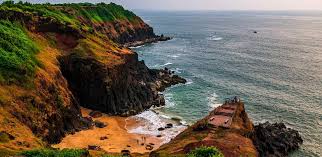
Ratnagiri is a port city on the Arabian Sea coast in Ratnagiri District in southwestern Maharashtra, India. The district is part of Konkan division of Maharashtra. The city is known for the Hapus or Alphonso mangoes. Ratnagiri is the birthplace of Indian independence activist Lokmanya Tilak. Thibaw, the last king of Burma, alongside his consort Supayalat and two infant daughters were exiled to a two-storied brick mansion in Ratnagiri. The building is now known as Thibaw Palace. This place has many villages like Karla, Rajiwada, Mirkarwada, etc.
Ganapatipule
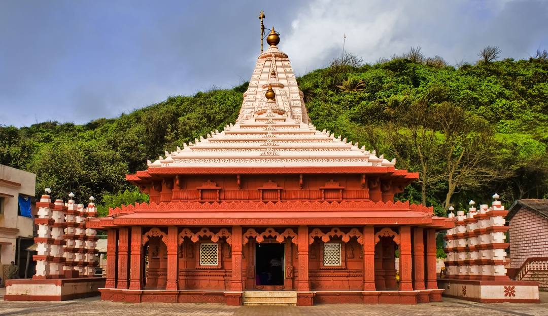
Ganpatipule is a town on the Konkan Coast of western India. It’s known for its beaches, such as Ganpatipule Beach and nearby Aare Ware Beach. On Ganpatipule Beach, the centuries-old Swayambhu Ganpati Temple is a pilgrimage site and houses a large orange statue of Ganesh. Prachin Konkan is an open-air museum with models depicting traditional Konkan life. Jaigad Fort and a British-built lighthouse lie to the north.
This 400-year-old temple is famous for housing the naturally formed monolith of Lord Ganesha which was discovered 1600 years ago. Ganapatipule Mandir, also known as Swayambhu Ganpati Temple, attracts many visitors throughout the year. The number of visitors increases during Hindu festivals like Diwali and Ganeshotsav.
While you can visit this town all year round, the best time to visit Ganapatipule is between October and March, when the weather is not too hot and humid. The beach town experiences wholesome downpour and low temperatures during monsoons.
Modak, the favorite sweet of Lord Ganesha, is a must have delicacy when in Ganapatipule. Another thing that the area is known for are the 'hapus' mangoes and must be relished while here. Other than this one can indulge in the luscious Fish curry and the Kokam curry available at an array of food joints across the place.